
Albany ZIP Code Coverage by Postal Area
Albany uses two documented postal ZIP codes, 97321 and 97322. They are postal service areas. They are not municipal districts, county borders, voting precincts, or parcel-ownership zones. The official city profile identifies Albany as a city in both Linn and Benton counties, so a street address must be checked in the appropriate parcel or map system after its postal format is confirmed. The precise delivery boundary for either Albany ZIP was not independently verified in the research, which is why an address-level USPS result is more dependable than an informal boundary map.
| ZIP | Areas Covered | Post Office | Notes |
|---|---|---|---|
| 97321 | Albany postal area; an exact delivery boundary was not independently verified | Albany Post Office detail | Validate the exact address, then identify the parcel's county separately. |
| 97322 | Albany postal area created from a portion of 97321 delivery points | No separate station or box-only designation was verified in the reviewed official sources | Older records may show 97321 for a place now using 97322. |
The USPS Albany Post Office detail is the official postal-location route identified for the 97321 context.
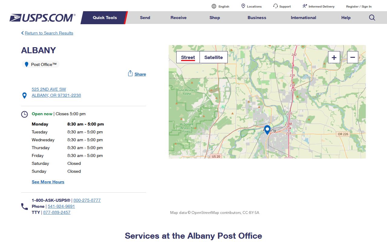
The postal detail supports a mailing and location check. It does not define all delivery boundaries or identify a person at an address.
Albany ZIP Codes Do Not Set County
An Albany city name or either ZIP code cannot choose between Linn and Benton County. The city crosses both counties. For most Albany property work, the documented starting route is Linn County Assessment & Taxation with the Linn County Clerk. A parcel west of the county line can require Benton County's TaxlotOwners service and its Digital Research Room instead. The county field, parcel identifier, and legal description are the facts that route a request to the right custodian.
The City of Albany GIS hub provides municipal context, while the county map or tax lot supplies the parcel context needed for records work.
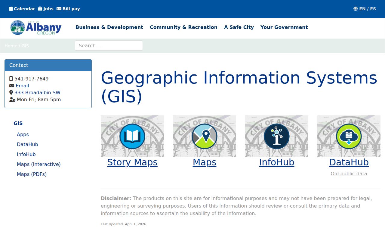
Use the city layer to orient an address, then retain the county result from the actual tax lot rather than deriving it from the ZIP code.
Linn's Planning map has a partial, non-exact Situs Address Search and a one-line Address Locator. Exact PIN and ACTNUM controls identify tax lots. Benton has a different public service, so the postal label should never override the county shown by the parcel record. A site can use one postal name while its recorder and assessment records are held by a different county.
Note: Preserve the full address, county, parcel identifier, and legal description together before requesting a deed, map, or assessment record.
The 2002 Albany ZIP Code Change
Albany's postal history has one documented change that matters when reading older records. The USPS Postal Bulletin states that 97322 was created on July 1, 2002, with 10,144 delivery points transferred from 97321. That was a postal adjustment, not proof that a parcel moved, a city boundary changed, or county custody shifted. An older city directory, permit, tax record, or deed can therefore display 97321 even when a current mailing address uses 97322.
The USPS Postal Bulletin notice creating 97322 documents the date and delivery-point transfer used for date-aware Albany ZIP code research.
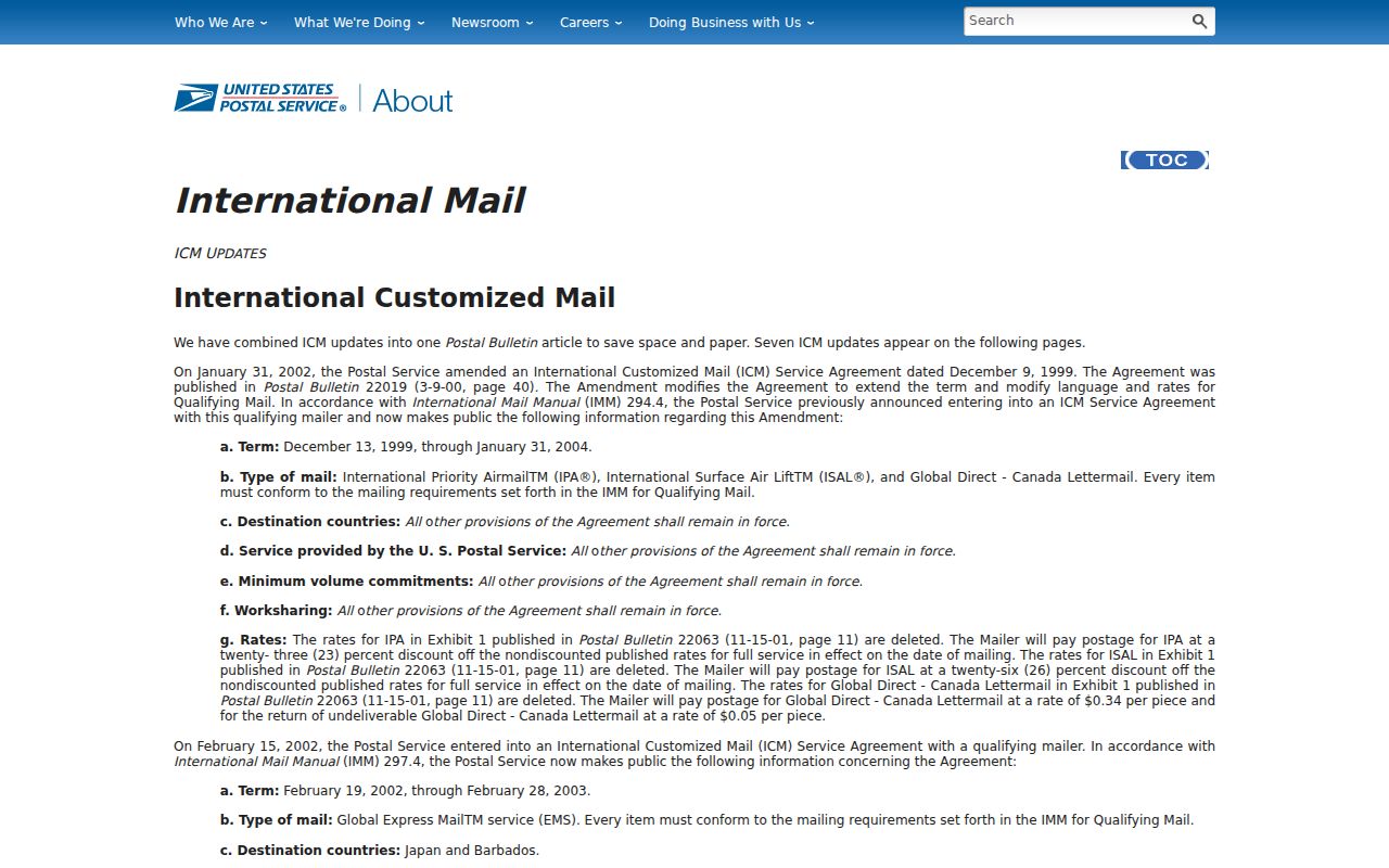
The notice explains why a historic postal suffix needs a date beside it before it is compared with a current address record.
Historic address work is strongest when the postal label is paired with a directory year, a map sheet, or the legal description from the recorded document. The research did not verify a citywide renumbering table, annexation-address change table, or a universal address-change rule. A mismatch should be investigated with the source year and parcel history, not repaired by guessing from a ZIP code.
Validate an Albany ZIP Code by Address
The official USPS ZIP Lookup offers three documented modes: Find by Address, Find by City and State, and Find by ZIP Code. Use it to standardize a delivery address or confirm the postal ZIP connected with a full address. USPS expressly says its result does not confirm a person or company at that address. It is therefore a postal validation step, not an identity or county-record search.
| Find by Address | Enter the complete street address to obtain the USPS postal result for that location. |
|---|---|
| Find by City and State | Use Albany and Oregon to inspect the postal lookup route, then validate a specific address separately. |
| Find by ZIP Code | Enter a ZIP to view USPS lookup information, without treating it as a county or resident filter. |
| Returned postal format | Keep the standardized address and ZIP in the research note, then compare it with county situs and mailing fields. |
USPS also publishes a ZIP label-list file, but the research did not locate an official public polygon that resolves every 97321 and 97322 delivery boundary. For a specific Albany address, the live address result is the safer postal check. Record the result's date, because a historic document can correctly use a different postal suffix.
Albany ZIP Code Parcel Workflow
A ZIP code narrows a postal question. The parcel workflow answers the property-record question. Begin with the complete address in USPS, then use the county system that holds the parcel. Linn's map can locate a site with partial address terms or exact tax-lot identifiers. Benton-side Albany parcels use the alternate TaxlotOwners layer, whose documented fields include party names, situs address and ZIP, tax-lot identifiers, and mailing-address fields. A recorded instrument remains the route for the legal transfer trail.
The Benton County public GIS services are the alternate-county path when an Albany ZIP result leads to a Benton parcel.
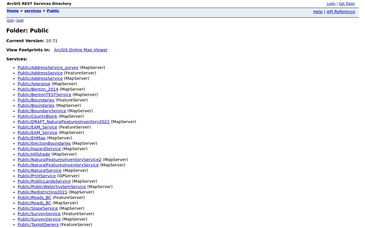
The Benton service helps separate a physical parcel address from a tax-correspondence address before an index or document request is made.
| Portal field | Entry rule | Useful result | Limit |
|---|---|---|---|
| Linn Situs Address Search | Partial, non-exact address terms | Mapped place, up to six matches | Locates a place; it is not ownership proof. |
| Linn PIN / ACTNUM | Exact entry | Tax-lot record | Requires an already identified identifier. |
| Benton SITEADDRESS / SITUSZIP | Parcel service fields | Physical site and postal context | Must be matched to the correct Benton parcel. |
| Benton MAILADDR fields | Tax correspondence fields | Separate mailing destination | It can differ from the physical site. |
Finding Residents Within an Albany ZIP Code
No inspected Albany, Linn, or Benton public portal was verified as a ZIP-wide resident browser or as a ZIP substitute for an address and parcel filter. That absence is important. The documented systems do different jobs: USPS validates a delivery format; a city or county map supplies geographic context; a county parcel service supplies a tax-lot record; and a recorder document supplies a legal and party trail. A ZIP code alone cannot produce a reliable list of people at addresses inside it.
- Enter the full address in USPS and retain the returned postal format and ZIP.
- Use the city and county map route to determine whether the actual parcel is in Linn or Benton County.
- Copy the situs address, parcel or account identifier, legal description, and any separately labeled tax-mail field.
- Use the appropriate county clerk or recorder route for a document index and read the actual instrument before interpreting a party name.
- For a dated household question, compare an appropriate year of the Albany city-directory collection or another dated local record.
Once a ZIP result has been narrowed to one street and one parcel, the Albany street directory route gives the fuller address-based sequence. Keep that street-level work separate from the postal check. Neither a ZIP result nor an assessed party proves every person associated with a location.
Note: Use public records for lawful personal research and never to stalk, harass, or harm another person.
Albany ZIP Code Situs and Mailing Fields
An Albany address can appear in several forms: a postal delivery address, a county situs address, a tax-bill mailing destination, a city permit address, or a deed legal description. They describe related but different systems. Preserve the field label rather than silently replacing one with another. In the Benton TaxlotOwners service, `SITEADDRESS`, `SITUSCITY`, and `SITUSZIP` describe the physical parcel location, while `MAILADDR`, `MAILCITY`, `MAILSTATE`, and `MAILZIP` describe tax correspondence.
- ZIP code and ZIP+4
- A ZIP is the basic postal area. ZIP+4 adds delivery detail, but neither format selects the Albany parcel's county or proves a person at the address.
- PO-box ZIP
- A postal designation for box delivery. No separate station or box-only designation for Albany 97322 was verified in the reviewed official sources.
- Unique ZIP
- A postal designation associated with a single organization or address. The research did not verify one for Albany.
- Carrier route
- A delivery grouping used by postal operations. The research did not verify a public Albany carrier-route lookup for property or resident research.
The legal description is the durable join key when a deed uses a lot, block, subdivision, metes-and-bounds, township/range/section, or an older address form. A ZIP and street label can change over time. The parcel identifier and legal description make it possible to test whether two dated records concern the same place.
Albany ZIP Code Boundaries and City Limits
Postal geography, municipal geography, county jurisdiction, planning layers, and local neighborhood names can overlap differently in Albany. A city-limit address can be in Linn or Benton County, and a ZIP code cannot settle that difference. The 1884 Sanborn set is catalogued as Albany, Linn County, for example, but that historic label should not be extended to the Benton portion of today's incorporated city. Select the record system that matches the question instead of treating one label as a universal boundary.
For a current location, start with the postal address, then the city or county map, then the actual county tax lot. For a historic location, pair the address form and publication year with a directory, map, deed, or plat. If two records conflict, preserve both forms and their dates. Ask the relevant county or city custodian about the underlying record rather than selecting the result that happens to fit the ZIP code.
Historic Albany ZIP Code Labels
Older Albany postal labels should be read in their own time. The 97322 transition is a clear reason not to reject a historical record merely because it shows 97321. A dated City directory page, 1884 Sanborn sheet, permit record, tax account, or recorded deed can each describe a different moment in an address trail. The city directory collection begins in 1878 and includes the address-oriented 1948 Householders Guide, while its published gaps remain 1912-1936 and 1942-1946.
For an older property question, compare the postal label with the address as printed, the county, the parcel or legal description, and the source date. Albany's historic resources are especially helpful for context, but they do not replace the proper recorder or assessment custodian. That distinction keeps a postal lookup, a map, and a recorded document in their correct roles.