
Walk an Albany Street Trail
Albany is incorporated in both Linn and Benton counties. A city name or a 97321 or 97322 postal address does not decide which recorder, assessment roll, or map applies. Begin with the complete street address, retain the directional form, and confirm the parcel county. The usual Albany street directory sequence is address to parcel, parcel to recorded document, then a properly requested voter record or a dated address publication when that later source fits the question. Do not treat an assessed owner, a tax-bill recipient, or a deed party as proof that every person at the site lived there.
- Validate the written address and locate the correct county parcel. For Linn parcels, use Linn Account Detail or the Planning map. For a Benton parcel, begin with the public TaxlotOwners service.
- Copy the parcel account, PIN or ACTNUM, legal description, and the source-labeled situs and mailing addresses. These values make a later deed or map check reproducible.
- Ask the proper recorder for the acquisition instrument. Linn has no verified unrestricted public web grantor-grantee index; Benton has the Digital Research Room for name, document-number, and date searches.
- Read the actual recorded instrument, then use its grantor, grantee, recording reference, and legal description to follow earlier transfers. A bare index result is only a lead.
- For a voter question, use Oregon Elections or the Linn County Clerk request route, not My Vote or a map. Then compare the appropriate dated Albany directory or the 1948 address guide for historical context.
Note: Record the source date at every step, because a postal result, property entry, deed, and directory are not all created at the same time.
Albany Street Directory Parcel Fields
The Linn Planning map is a parcel-first locator, not a street roster. Its one-line Situs Address Search accepts partial, non-exact terms and returns no more than six matches. Its Address Locator also accepts one line. Tax-lot searches use exact PIN and ACTNUM entries, while Sales Recording offers a partial, non-exact text search. Save the county's labels as displayed rather than replacing them with a simplified address.
| Albany record tool | Captured field or filter | Entry behavior | Use and limit |
|---|---|---|---|
| Linn Planning map | Situs Address Search; Address Locator | One line; situs search permits partial, non-exact text and up to six matches. | Locates a mapped place and parcel context, not a current household list. |
| Linn Planning map | PIN; ACTNUM; Sales Recording | PIN and ACTNUM require exact entry; Sales Recording permits partial text. | Joins a tax lot to map and sale context. |
| Albany Accela | Address, record number, project name, parcel, date, status | Building, Planning, and Public Works modules can also show applicant or contractor-style criteria depending on the module. | Finds a public permit or application lead, not assessment ownership. |
| Benton TaxlotOwners | SITEADDRESS, SITUSZIP, MAILADDR, mailing ZIP, account/map/tax-lot | Site, mailing, party, and parcel fields are distinct. | Serves Albany parcels actually in Benton County. |
| Benton Digital Research Room | Last or business name, first name, document-number year/range, recording-date range | Supports a percent wildcard. | Searches the Benton recorded-instrument index. |
The public Linn tax-lot service can return a PIN, map, ACTNUM, owner and agent or mailing fields, situs street/city/ZIP, sale, legal subdivision/block/lot, values, acreage, and building characteristics. Its sample record shows why situs and mailing addresses must remain separate. An owner field is a property clue, not a declaration of who currently occupies the address.
Albany Streets Across Counties
County confirmation comes before a street-by-street search. Linn Assessment & Taxation says its public account flow is Account Number or Situs Address, then Summary Report and the GIS menu; the county also says property searches can use an account number, name, or address. The Linn GIS hub and the City GIS hub help establish jurisdictional context, but the actual tax lot decides the property custodian. A postal ZIP and the word Albany in a mailing line do not settle the issue.
For a Benton-side Albany parcel, retain the TaxlotOwners site address, situs ZIP, mailing fields, account, and map-tax-lot formatting. For Linn, retain the planning map's PIN or ACTNUM and the account detail identifier. The legal description is the durable bridge when a street form changes or a record uses lot, block, subdivision, township, range, or section instead of a street address.
- Parcel
- A specific piece of land tracked by an account, tax lot, PIN, ACTNUM, or similar county identifier.
- Situs address
- The physical address of the parcel. It differs from a mailing address used for tax correspondence.
- Plat
- A recorded map that can show a subdivision, lot, block, boundary, or corner reference. It helps interpret a legal description but does not list a household.
- Criss-cross directory
- An address-oriented directory arrangement. Albany research documents the 1948 Householders Guide as the local address-first aid; it does not support a claim that every Albany directory is a criss-cross volume.
Albany Permits by Street Address
Albany Accela supplies an address-based route for Building, Planning, and Public Works records. The documented public portal begins November 18, 2014. Requests concerning work before November 17, 2014 belong on the City's older record route. A permit can supply a project, parcel, review date, status, or public project material. It does not convert a street address into a list of people.
Use Albany Accela's address search as a dated permit lead in an Albany street directory search.
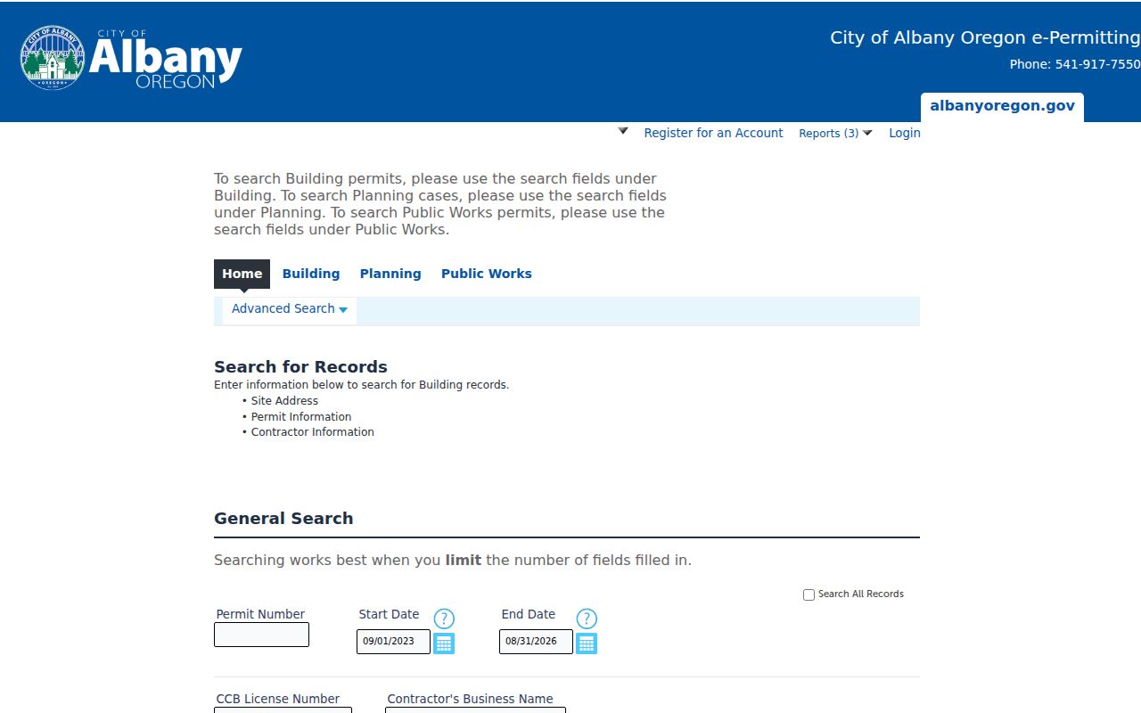
Use the address, record number, or parcel as the portal permits, then preserve the module and displayed date with the result. A permit trail may explain a building project without establishing a present or past household.
Note: Ask for an identified existing file, date range, and street address when a portal result ends, rather than asking the City to create a new analysis.
Albany Street Directory Record Coverage
Address-keyed Albany records overlap, but none supplies a complete street census. The table separates what an address can lead to from what each custodian actually proves. Start with the county parcel, then use the document, map, permit, historic publication, or authorized voter-list channel that matches the date and purpose of the question.
| Address-based Albany source | Keeper or route | What a street address may lead to | Key access boundary |
|---|---|---|---|
| Tax account and parcel map | Linn Assessment/Planning map; Benton TaxlotOwners | Parcel/account, situs, legal description, assessed party, tax-mail fields, map layers. | Assessed party and tax-mail recipient do not establish every person at the site. |
| Recorded instrument | Linn Clerk, or Benton Digital Research Room then recorder copy | Recorded parties, date, document number, legal description. | Use the correct county and read the full instrument. |
| Survey, plat, or corner record | Linn Surveyor Database Viewer or recorder | Lot, block, subdivision, survey reference, boundary context. | It does not report current household data. |
| City permit or planning file | Albany Accela or City records request | Project, address/parcel, review date, status, public project material. | Coverage depends on date and module; older files use the prior route. |
| Historic directory or Householders Guide | Albany PDFs, library, or museum | Dated address, name, or household clue. | It is publication-year evidence with stated gaps, not a current list. |
| Voter-list request | Oregon Elections or Linn County Clerk | Statutorily public elector-list elements, subject to exclusions. | It is not a live block browser and has statutory use limits. |
The linkage is not just the street name. A parcel identifier or legal description ties a map to an instrument. A publication date ties a historical directory entry to its own moment. Using the wrong join key can merge separate properties or imply a connection the source never made.
Albany Street Deed and Plat Links
After locating a Linn parcel, ask the Linn County Clerk recording desk for the acquisition instrument using the assessed party, legal description, parcel identifier, or known recording date. The office reports a first generated copy at $4, additional copies at $0.25, and certification at $3.75 per document. Written requests and mail payment by check or money order are documented alternatives to counter service. No emailed or faxed recording documents are accepted.
The State Archives inventory describes public-access Clerk computers for daily recorded instruments from 1986 forward, a Clerk-office computer for records from 2006 forward, and 885 microfilm reels for daily recorded instruments from 1970 through 2005. Direct and indirect deed indexes begin in 1854. Those boundaries are custody and access clues, not a promise that every document image is available remotely.
Use Linn County Clerk recording access after parcel work in an Albany street directory search.
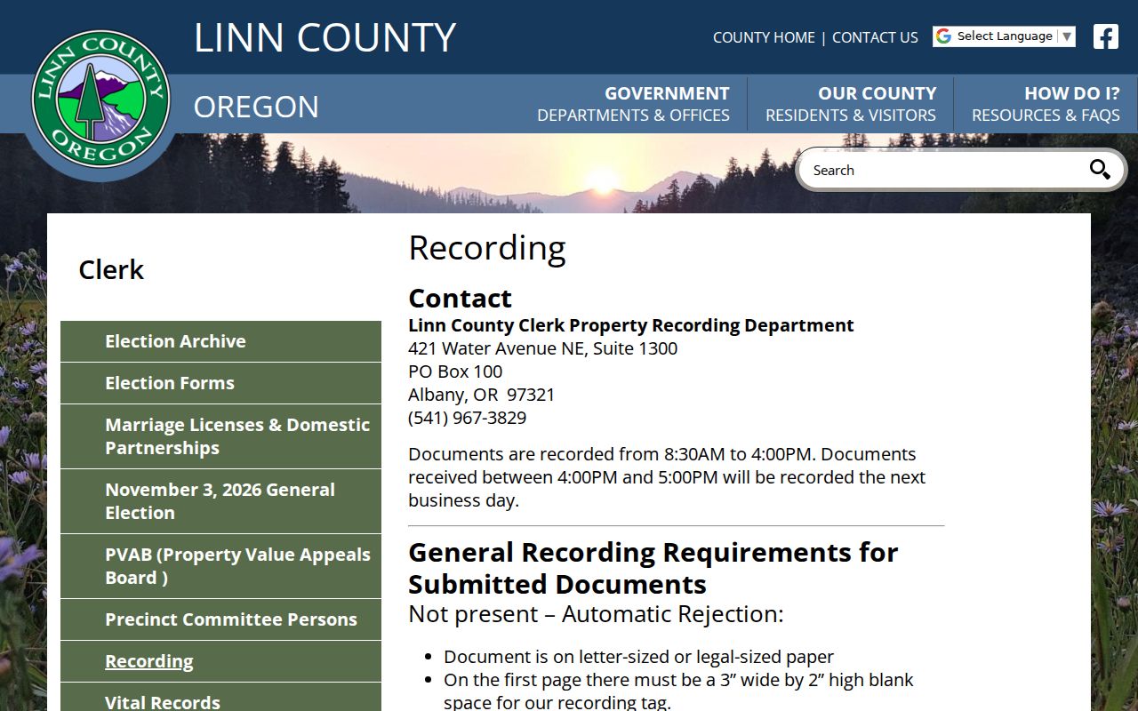
Read the recorded instrument for the legal description and recording reference before carrying a party name backward. On the Benton side, use the Digital Research Room's index and then obtain the relevant recorded document from the Benton custodian.
Albany Street Survey Context
The Linn Surveyor Database Viewer can be searched by Survey Number, Survey Book/Page, Corner Number, Subdivision, Township/Range/Section, Tax Lot, or Name. A result can identify a survey or corner reference and may include linked images. It is useful when map shapes appear adjacent but a lot line, partition, or subdivision record needs confirmation.
The public Linn Surveyor Viewer provides the survey and corner record layer used with an Albany street directory search.
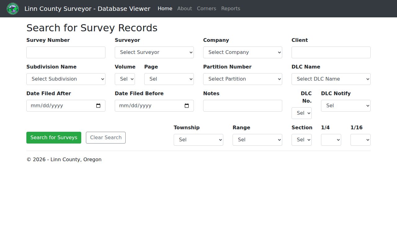
A survey image or plat supports boundary interpretation and the legal-description trail. It does not establish who lived on the parcel. Preserve the survey number and filing details with any address note.
Albany Street Directory History Clues
Albany's digitized city-directory collection contains 40 volumes beginning in 1878. The City identifies two significant gaps, 1912 through 1936 and 1942 through 1946. Search the relevant PDF's OCR for the exact address and review the page image, but do not turn a missing volume or a blank OCR result in one of those gaps into an absence claim. The local collection belongs to a date, not to the present street.
The 1948 Albany Householders, Street & Avenue Guide is the strongest documented Albany address-first aid. It is a one-year publication with a different arrangement from a name-oriented city directory. For the historical shelf itself, use the Albany city directory page; retain only the specific year and address clue needed for a street record trail here.
Albany Street Postal Details
Albany uses postal ZIP codes 97321 and 97322, but neither is a county line or parcel boundary. USPS created 97322 on July 1, 2002 by moving 10,144 delivery points from 97321. A historical record with 97321 may therefore be consistent with a later standardized address. The USPS ZIP Lookup offers Find by Address, Find by City and State, and Find by ZIP Code, yet USPS states that a result does not confirm a person or company at the address.
Use a complete address first, then retain four values: the postal address and ZIP, situs address, county jurisdiction, and parcel or legal identifier. Search older addresses with and without a directional prefix or suffix, but preserve the form that the authoritative record displays. No verified official citywide Albany renumbering table exists, so an apparent mismatch needs maps, plats, a dated directory, and the legal description rather than a guessed conversion.
Note: A postal correction changes delivery formatting, not the county custody of a deed, tax account, or survey record.
Albany Street Records by Era
Albany's address history reaches beyond modern portals. Linn County was created in 1847, became seated in Albany in 1851, and has deed records from 1853 with direct and indirect indexes beginning in 1854. The Oregon State Archives Linn inventory identifies the relevant series, span, and repository. It prevents a common error: interpreting a failed current search as proof that an older record was never kept.
Pair the target date with the correct route. A recent parcel may lead to an assessment record, a 1970s transfer may require the daily-instrument microfilm trail, and an earlier deed may need an index book or Archives reference-room direction. The City directory, 1948 guide, or 1884 Sanborn set can add dated street context, but the recorded legal description remains the stronger property join key.
Albany Street Directory Limits
An Albany street directory cannot disclose every person connected with an address. It cannot reliably establish household relationships, delivery accounts, protected addresses, driver-license address data, or a complete unit-by-unit list. A parcel map shows land records. A tax mailing address may be a correspondence destination. A historic directory places a listing at publication time. Keep those limits next to the result rather than turning one record into a claim about a whole street.
Oregon's voter-list request process is the permissible path for public elector-list material. My Vote is elector self-service and was protected by CAPTCHA during research; it is not a public by-address finder. Public list material has exclusions for protected information, ballot choices are never shown, and Oregon law restricts commercial use. County lists and statewide or less-than-statewide electronic lists follow the official request process and its stated timing and fees.
Lawful use. Use Albany street records for personal, civic, family-history, or property research. Do not use any address-based record to stalk, harass, intimidate, or harm another person.